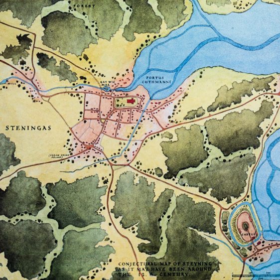
Here is one of several maps at Steyning Museum which show how the area developed over the centuries. On this map Steyning is Steningas, Bramber is Brymmburh and Saint Cuthman’s Port is Portus Cuthmanni.
This is how Steyning and Bramber may have appeared in the late 11th century. The church of Saint Andrew looks out over the old Saxon port of Saint Cuthman, but the port has already begun to silt up and decline has set in. Nonetheless, Steyning is held by the rich and powerful abbey of Fécamp in Normandy and the town is expanding under Norman rule.
At Bramber, William de Braose has built the castle and church which will remain the “caput” of the Braose family until 1326. This ferocious Norman lord has also built a causeway and a bridge to cross the river Adur. His domination of the river is a threat to the port of Saint Cuthman, a cause of serious dispute between the abbey and the Braoses. Even the intervention of King William the Conqueror at a hearing before his full court has failed to resolve the issues. But as the river silts up further, a major new port is established by William’s son Phillip, on the river mouth at Shoreham.
See our article about the Braose lords of Bramber and an article about Fécamp Abbey and Steyning HERE.
Copies of our maps are available to buy in our Museum shop.